- Region
- Águilas
- Alhama de Murcia
- Jumilla
- Lorca
- Los Alcázares
- Mazarrón
- San Javier
-
ALL AREAS & TOWNS
- AREAS
- SOUTH WEST
- MAR MENOR
- MURCIA CITY & CENTRAL
- NORTH & NORTH WEST
- TOWNS
- Abanilla
- Abarán
- Aguilas
- Alamillo
- Alcantarilla
- Aledo
- Alhama de Murcia
- Archena
- Balsicas
- Blanca
- Bolnuevo
- Bullas
- Cañadas del Romero
- Cabo de Palos
- Calasparra
- Camping Bolnuevo
- Campo De Ricote
- Camposol
- Canada De La Lena
- Caravaca de la Cruz
- Cartagena
- Cehegin
- Ceuti
- Cieza
- Condado de Alhama
- Corvera
- Costa Cálida
- Cuevas De Almanzora
- Cuevas de Reyllo
- El Carmoli
- El Mojon
- El Molino (Puerto Lumbreras)
- El Pareton / Cantareros
- El Raso
- El Valle Golf Resort
- Fortuna
- Fuente Alamo
- Hacienda del Alamo Golf Resort
- Hacienda Riquelme Golf Resort
- Isla Plana
- Islas Menores & Mar de Cristal
- Jumilla
- La Azohia
- La Charca
- La Manga Club
- La Manga del Mar Menor
- La Pinilla
- La Puebla
- La Torre
- La Torre Golf Resort
- La Unión
- Las Palas
- Las Ramblas
- Las Ramblas Golf
- Las Torres de Cotillas
- Leiva
- Librilla
- Lo Pagan
- Lo Santiago
- Lorca
- Lorquí
- Los Alcázares
- Los Balcones
- Los Belones
- Los Canovas
- Los Nietos
- Los Perez (Tallante)
- Los Urrutias
- Los Ventorrillos
- Mar De Cristal
- Mar Menor
- Mar Menor Golf Resort
- Mazarrón
- Mazarrón Country Club
- Molina de Segura
- Moratalla
- Mula
- Murcia City
- Murcia Property
- Pareton
- Peraleja Golf Resort
- Perin
- Pilar de la Horadada
- Pinar de Campoverde
- Pinoso
- Playa Honda
- Playa Honda / Playa Paraíso
- Pliego
- Portmán
- Pozo Estrecho
- Puerto de Mazarrón
- Puerto Lumbreras
- Puntas De Calnegre
- Region of Murcia
- Ricote
- Roda Golf Resort
- Roldan
- Roldan and Lo Ferro
- San Javier
- San Pedro del Pinatar
- Santiago de la Ribera
- Sierra Espuña
- Sucina
- Tallante
- Terrazas de la Torre Golf Resort
- Torre Pacheco
- Totana
- What's On Weekly Bulletin
- Yecla


- EDITIONS:
 Spanish News Today
 Alicante Today
 Andalucia Today
A history of Totana
Successive cultures have left their mark on the town of Totana over the millennia
 Totana today is a pleasant and characterful town at the centre of a municipality which includes part of the mountains of Sierra Espuña and large areas of fertile agricultural land just a short distance from the Mediterranean beaches of the Costa Cálida, and the same geographical characteristics which make it an attractive place to live and visit in the 21st century have been attracting settlers for millennia.
As is the case with the rest of the Region of Murcia, the story of Totana, which for a long time was little more than an outlying district of its neighbour Aledo, is one which comprises different peoples and differing fortunes over the last four millennia. The Argaric culture is represented by the archaeological site of La Bastida, the Romans played their part, and the Moors developed agricultural infrastructures before the Christians conquered south-eastern Spain in the 13th century, converting Totana into a dangerous frontier area close to the frontier with the Moorish kingdom of Granada.
Since then, the story has been one of uneven growth, of three steps forward followed by two steps back, leading to the relative stability and prosperity of the present day.
Early pre-history in Totana
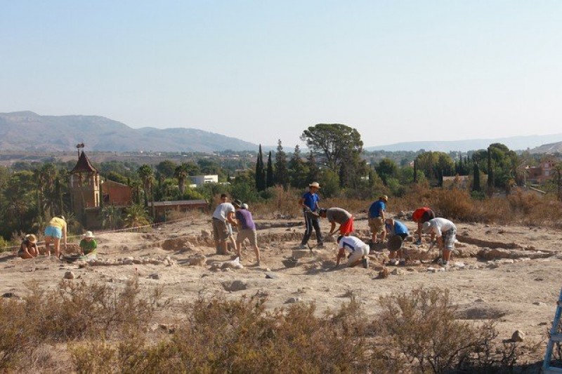 The origins of Totana go back to pre-historic times, and there is evidence of human habitation dating from the Middle Paleolithic, over 40,000 years ago at the site of Cejo del Pantano, where stone tools have been discovered. Upper Paleolithic remains have been found at the same location, and also at Los Mortolitos, the Cueva de Hernández-Ros and the Cueva de la Tazona.
But Totana first became an important area for human activity in the Eneolithic (or Copper Age), when the south-east of the Iberian Peninsula in general and the Guadalentín valley in particular, saw a significant increase in population. Particularly noteworthy is the settlement at Campico de Lébor, a flat-topped hill on the right bank of the Rambla de Lébor: the settlement was built around the hill, providing it with natural fortification, and to the south-west of this hill is the Cerro de los Blanquizares, a burial site for the Copper Age population at nearby Lébor.
In the 1930s Juan Cuadrado Ruiz excavated a series of graves at Los Blanquizares, and found that the funeral rite at that time consisted of mass burials. In addition, he unearthed grave goods of all kinds, the most precious find being an axe with a wooden handle which is now on display at the archaeological museum of Almería.
However, the earliest evidence of settlements in the town of Totana itself dates from between the third millennium BC and 1900 BC. The remains found at the Cabezo de Santa Lucía (now home to the “La Cárcel” sociocultural centre) include smooth Copper Age ceramics, a bell-shaped ceramic fragment, burnished ceramics and stone and copper items, all of which can be seen in the archaeological museum of the city of Murcia.
The Argaric culture and the settlement of La Bastida
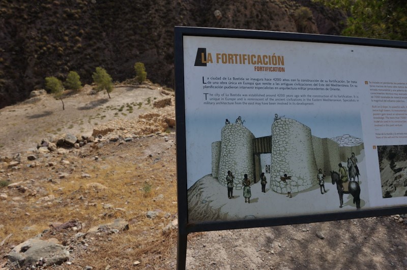
The municipality of Totana is home to one of the most important sites in Spain related to the Argaric culture, which flourished between approximately 2200 BC and 1500 BC: this site is known as La Bastida, and it stands on a cone-shaped hill which reaches 535 metres above sea level between the Rambla de Lébor and the Barranco Salado.
La Bastida is believed to have been occupied without interruption for a period of around 700 years before its irrevocable decline began in approximately 1500 BC, and it reached the height of its importance in around 1580 BC. The site has been extensively excavated, revealing more and more about the complex city life on the hill, and there is evidence which suggests a hierarchical society with the site populated over a wide area, with noticeable differences between the properties at the higher and lower levels.
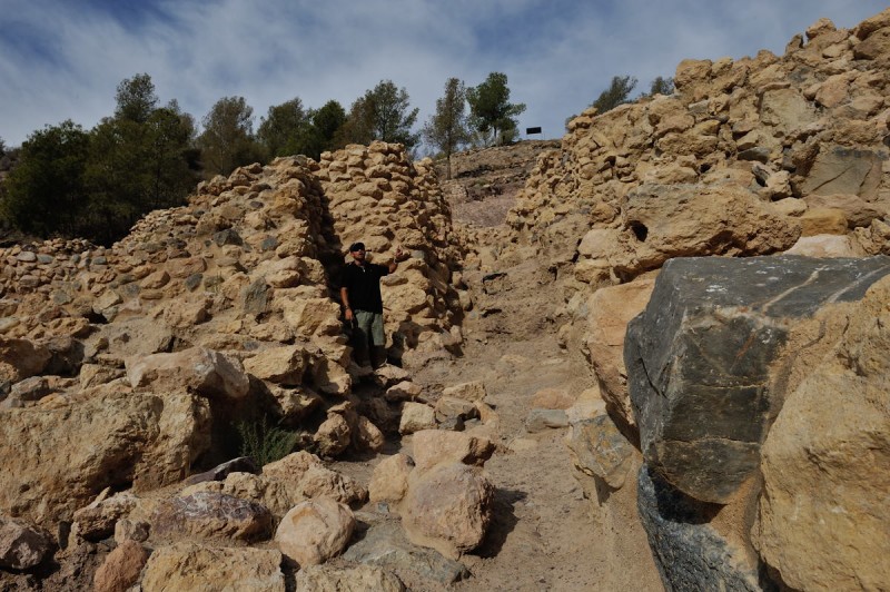
Only the north side of the hill is easily accessible, and it is believed that this part may have been defended by a fortified wall, with a substantial entrance gate still standing.
The site has been one of the most important in the development of prehistoric archaeology in Spain, partly due to its size (40,000 m2, of which only 6,000 or so have been studied) and partly due to the number of inhabitants: it is believed that La Bastida was populated by as many as 600 people.
The first excavations were overseen in 1869 by Rogelio de Inchaurrandieta, who confirmed that the population subsisted principally on cereal crop farming (wheat and barley) as well as consuming hunted and farmed meats, and evidence has since been found of textile and metallurgical activities.
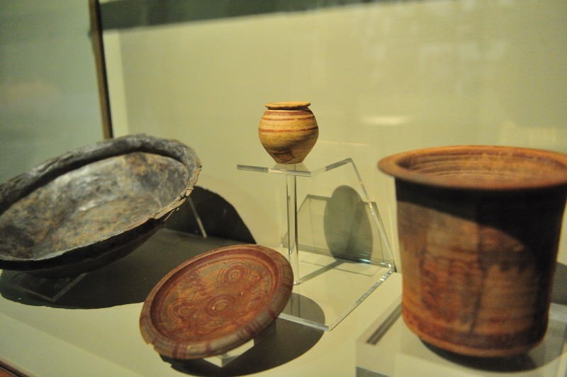
 Funeral rites at La Bastida consisted of individual burials beneath the floors of the domestic dwellings, and two types of grave have been found, with the bodies placed either in cists (stone-walled coffins) or, more commonly, in urns. The cists consisted of four long slabs of stone forming four sides, with a lid placed on top, while the urns were ceramic earthenware jars with a stone lid. In both cases the body was placed inside with the knees folded against the chest, and was accompanied by grave goods, which generally included household objects such as cups with food inside, decorative jewelry (rings, stone pendants, and other items fashioned from bone, shells, bronze and silver) and, in the case of men, weapons, such as daggers and swords.
These have helped to form an accurate body of information about the social differences within the population, the specialisation of individuals in different tasks and the sources of the grave goods also helping to confirm that the Argaric culture had a sophisticated structure with strict controls and conformity.
The La Bastida site can be visited at weekends - click for further information – and other Argaric remains in Totana are at Cabeza Gorda, Los Yesares and Las Anchuras.
The Iberians in Totana
 After the disappearance of the Argaric culture (believed to have been caused by over-exploitation of the natural resources available and health problems relating to the limited diet of which this was a result) and the next significant settlement known to have existed in Totana was in Las Cabezuelas, which is located on a small hill not far outside the built-up area of the modern town and which reached its zenith in the time of the Iberians (in the second half of the 1st millennium BC).
No evidence has been found that the site was fortified, and it has been established that the inhabitants subsisted on their crop farming and cattle rearing activities. They also worked with ceramics, and important relics have been found from between the 6th and 1st centuries BC, including amphorae, pottery, plates and pieces using the “kálathos” style.
During the second and first centuries BC the Iberian inhabitants began to make their way down the hill to the area now occupied by the town of Totana, and evidence of this gradual migration can be seen in the Ibero-Roman materials from the later Roman periods.
The Romans in Totana
The Romanization of Totana began at the start of the 1st century BC, although it was not until the later years of the Republic that it appears to have become truly prosperous, shortly before the decline of the Romans and their departure from the Iberian Peninsula.
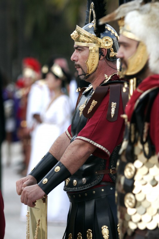 Totana was not a major town, and the presence of the Romans consisted largely of “villas”, which in this part of Spain were farming concerns. They used irrigation systems to cultivate their crops, transporting the water from the River Guadalentín via the use of aqueducts such as the Espuña aqueduct.
Archaeological digs have not focused much on the presence of the Romans in Totana, but the settlement of what is now the town centre has been identified as a “mansio”, a stopping off point on the Via Augusta, which ran through the Guadalentín valley on its route from Carthago Nova (Cartagena) to Cástulo (Linares). One historian has concluded that Totana, which was known by the Romans as “Mave”, was populated mainly by Jews who had been expelled from the province of Tarraconense (modern-day Tarragona) in punishment for their alleged incestuous practices.
The later name change is attributed to the decision to name the town after the monstastery of Tutanesio in the province of Toledo.
The most important Roman relic found in Totana was a milestone which was found by Franciscan monks when they were laying the foundations of the Convento de San Buenaventura in the 17th century. Although the milestone has unfortunately been lost since its discovery, we do know that it bore an inscription related to the Emperor Augustus, who ordered the repair of the road in the Via Augusta 8 BC. A fragment of the Roman road itself was also discovered, consisting of large stones placed on a layer of compacted earth and sand.
Other important relics include the tombstones dedicated to Fabato (1st century AD) and Mystico (2nd or 3rd century AD).
Ceramic relics from the period include a Roman “olpe” (a type of jar) painted in the Iberian style which was found in Calle San Antonio, and this and other items suggest the existence of a Roman population laid out roughly along the same lines as the modern-day town along the banks of the Rambla. Augustus made the town the capital of the district, before in 216 AD Emperor Caracalla moved his capital to Eliocroca (Lorca).
After the Romans
There are hardly any historical references to Totana from the 4th to the 10th century AD, and the only thing we know for certain is that life in the area continued to feature many of the characteristics which were determined during the rule of the Romans. The economy continued to be rural, and it seems that the arrival of Islam in the peninsula in 711 did not bring about any drastic upheaval. Change was gradual all over southern Spain, particularly in small communities like Totana.
Totana under the Moors
At least one archaeologist maintains that Totana can be identified with the city known as Balantala in the Moorish kingdom of Tudmir, a location which is mentioned by the Moorish chronicler al-Udri in the 11th century. Balantala was one of the seven cities included in the pact between Abd-al-Aziz, the Arab chieftain, and Theodomir, the Visigoth governor, in 713, the other six being Orihuela, Lorca, Mula, Alicante, Elche and Ello, and the basis for reaching this conclusion is not only geographical, but also archaeological (the existence of Roman ruins in Totana) and linguistic (“Balantala” could be derived from the Moorish name “Tawtana”).
In the year 779 the troops of emir Abderrahaman I overran Totana, according to al-Udri, and the surrounding land was distributed among the emir’s supporters, enabling them to take advantage of the rich soil of the Guadalentín valley, although most of them opted to live in the secure fortress at Aledo, in the Sierra Espuña. Three important earthenware pots from the 11th and 12th centuries have been found at Las Cabezuelas and are now on display in the archaeological museum of Lorca, and reference is made to Totana with the spelling of “Tawtana”.
The Moors used the land in the valley for agriculture, the Sierra Espuña giving them shelter and higher ground when needed, and developed a network of irrigation ditches which enabled them to cultivate cereal crops and leaf vegetables. They also undertook hydraulic engineering work and built canals, as can be seen in the findings made in El Raiguero, but unfortunately, as is the case in almost the whole of the Region of Murcia, the lack of surviving documentation makes it difficult to establish details relating to the five centuries of Moorish occupation and rule.
Totana after the Reconquista
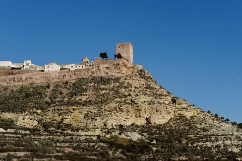 In 1243 the Treaty of Alcaraz was signed (sometimes known as the Capitulations of Alcaraz), cementing the Reconquista of the kingdom of Murcia by Prince Alfonso (later Alfonso X “El Sabio”) of Castilla. Alfonso named his brother Manuel as governor of the area before placing both Aledo and Totana in the hands of the Order of Santiago in 1257, and from that point onwards it was the Order who appointed the “concejiles” (Mayors) and ecclesiastical authorities.
Due to its lack of natural and artificial defences Totana was a relatively dangerous place to live, and was frequently the target for Moorish incursions as they crossed the nearby frontier between the reconquered Christian territory and the Nazarid kingdom of Granada. As a result it was practically abandoned in the 14th and 15th centuries, being used only to sell local merchandise to travelers in the valley. The Order of Santiago built an inn in Totana, which was used to levy taxes on passing merchandise and cattle, and the Catholic monarchs, who were also the administrators of the Order, afforded privileges to the town of Aledo and its suburb Totana, exempting its inhabitants from the payment of certain taxes: it has to be remembered that at this stage in its history Totana was overshadowed in every sense by the fortified settlement of Aledo which stands above and behind it in the Sierra Espuña.
Totana itself did not achieve the status of “villa” until the completion of the Reconquista with the taking of Granada in 1492: although there were subsequent uprisings, this more or less marked the end of the insecurity of living in this part of Murcia. It was only now that significant numbers of people from Aledo began to move down from their walled town to the flatter land around Totana, a few kilometres away, and by the early 16th century the valley town of Totana was becoming larger and more important than its hilltop neighbour.
The expansion of Totana
As the years passed after the Reconquista Totana continued to grow, while Aledo dwindled in size, and in a misguided attempt to halt this decline in 1517 the authorities banned the construction of all new houses in Totana except those needed to accommodate farm workers. This order was widely disobeyed and in the following years even the Mayors, administrators and priests took up residence in Totana.
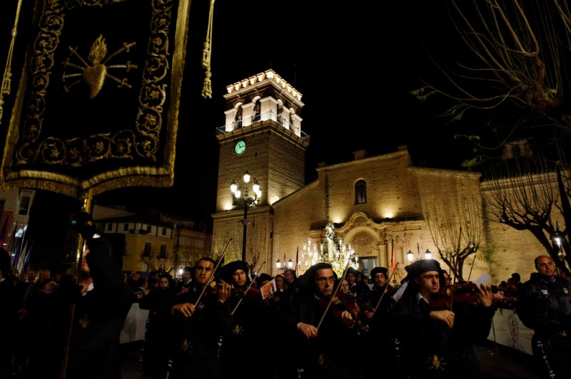 By the start of the 16th century the ascendency of Totana was definitive, and during the rest of the century a new town was created, the only instance of this happening in the Region of Murcia at this time except for the case of Alguazas. In 1550 it was agreed that the town council meetings should be held in Totana, and Aledo was relegated to the status of “pedanía”, or outlying village.
Totana was now the leading town of the municipality, mainly due to the wishes of the rich families who owned the farmland and lived off the profits of agriculture. In 1553 a papal bull issued by Pope Julius III authorized the Order of Santiago to move from Aledo to Totana, and work began on the construction of the Church of Santiago before the churches of San Cosme and San Damián were founded in the following century.
The economy of the town grew and became more diverse, one example being the construction of the snow wells in Sierra Espuña in the 16th century. These were in use until the end of the 19th century, supplying work and income for numerous families in the winter, which had previously been a lean season with widespread unemployment.
The new design of the town was based on two residential areas known as Sevilla and Triana, on either side of the Rambla de la Santa. The former contained most of the main religious and civic buildings, as well as the routes leading to Murcia, Cartagena, Lorca and Mazarrón, while the latter was home to paid workers and peasants as well as the Franciscan monks, making it the poorer side of the Rambla. The names of the two areas came from the commercial relationship which had grown between Totana and the city of Seville after many natives of Totana went to work in the capital of Andalucía in the soda and barrel-making industries.
But the growth of the town was precarious, as was illustrated during the 16th century by the outbreaks of plague which affected the Region of Murcia and in which the population was decimated. The century also brought famine and meteorological catastrophes, and the plague added to the hardships suffered in this period.
However, the social fabric of endemic poverty was an ideal spawning ground for the religious brotherhoods who spread charity and good deeds in the town in the Early Modern period. This social work, aimed at helping the poor, also provided a convenient means for the rich to save their souls by funding the brotherhoods’ activities, ensuring the prosperity of the “cofradías” of the Santísimo Sacramento, Nuestra Señora de la Concepción, Santa Lucía and San Pedro, among others.
Prosperity in the 18th century
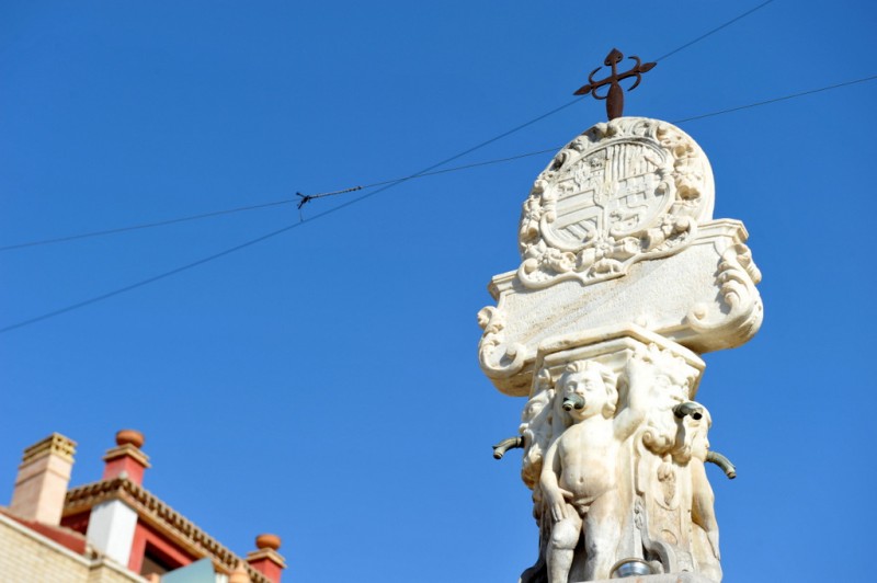 In Totana, as in the rest of Murcia, the 18th century was something of a golden age. It began with the support given to Felipe V in the War of Succession, in return for which Totana received the title of “Noble” in 1709, and continued with the construction of the reservoirs of El Paretón and Lébor, which made it possible to irrigate far larger areas of land.
The town centre was embellished with various new buildings, including the façade of the Church of Santiago and the Fuente Monumental, which was sculpted by Juan de Uzeta, a craftsman from Lorca, and is the only remaining baroque fountain in the whole of the Region of Murcia. The census of 1755 found that Totana had 2,303 inhabitants, of whom only 201 lived in Aledo. The town had a whole range of services, including ten water mills, seven mills for producing olive oil, fifteen bread ovens, five saltpeter cauldrons and two tileworks.
The office of Mayor of Totana was created in 1713, and in 1795 Totana and Aledo finally parted company, becoming two separate municipalities after sharing centuries of their history.
Mixed fortunes in the 19th century
The 19th century started badly for the town of Totana. In 1802 the dam burst at Puentes in the municipality of Lorca, flooding the fields and destroying other dams and irrigation channels. Soon afterwards the War of Independence (1808-14) broke out, and although Totana was not invaded by the French, the elderly, the women and the children took refuge in the castle of Aledo. In 1810 there was a calamitous outbreak of yellow fever, and the population fell from 10,000 to 5,000. After all these problems there was no significant rise in the population until 1830, when work began on the reservoir at La Carabela, bringing about a resurgence in agricultural activity.
On 13th May 1834, Totana became the seat of the area’s judiciary, which was responsible for an area including Aledo, Alhama de Murcia, Librilla and Mazarrón, and by the middle of the century the recovery was gaining momentum. Agriculture spread to the foothills in Mortí and La Huerta, where oranges became the crop of preference, new houses were built (some of these still survive in the old town) and new residential areas grew, including Los Pasos, near the Ermita del Calvario, making it necessary for new roads to be created.
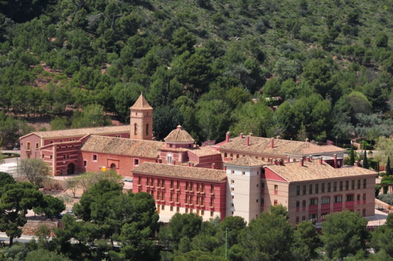 Towards the end of the century, though, the town’s fortunes suffered another downturn, with many of its inhabitants leaving to search for a better life elsewhere. Despite this, the opening of the railway in 1885 brought an important flow of domestic trade along the Guadalentín valley, and the Town Hall ordered the construction of emblematic buildings designed by Justo Millán, including the Cemetery (1885) and the judiciary prison (1884), which is now the “La Cárcel” social and cultural centre. Both of these were designed by Justo Millán. In Sierra Espuña, the mountain engineer Ricardo Codorniú initiated the reforestation of thousands of hectares with Carrasco pines in the course of a project which has since become a model for all hydrological and forestry interventions.
Totana becomes a city
The most important figure in Totana in the early 20th century was General Aznar, adopted as one of their own by the people of the town and heavily committed to its development. This liberal politician was instrumental in Totana being declared a city by King Alfonso XIII in 1918.
Around 1930 the population fell significantly as a result of problems with the water supply, and re-growth didn’t occur until the problem was solved and new crops could grown. The shoots of recovery, though, were nipped in the bud by the Civil War (1936-39).
After the hardships of the post-war period, Totana bore witness to another period of growth in the 1960s. The city itself grew towards the south, where the Avenida Juan Carlos I now lies, and new residential areas sprang into existence in Era Alta and Las Cabezuelas, outside the traditional limits of the built-up area. Much of this was due to the migration of inhabitants from outlying districts such as El Raiguero and parts of the municipality of Lorca.
By the 1980s the city had spread to the other side of the RN-340 and the Avenida Juan Carlos I, and the areas of Las Peras, Tirol-Camilleri, El Parral, La Cerámica and La Ramblica had been incorporated.
Totana today
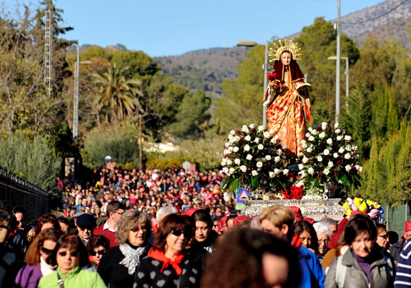
Totana now has almost 34,000 inhabitants, and since 1990 many immigrants have arrived in the municipality. Most of the population now reside in the city itself, but there are outlying villages in El Paretón, Raiguero, Lébor, La Huerta, Las Viñas, Mortí, La Ñorica and Sierra Espuña. The clay pottery industry continues to provide a link between past and present, with various family workshops still producing high quality items, and there are also industries related to leather, wrought iron and embroidery.
Apart from traditional crafts, the main economic activity continues to be agricultural, and the local peppers have been awarded protected geographical status. Tourism is also growing in importance, with the Regional Park of Sierra Espuña and the rich history of the municipality, especially La Bastida, being the major attractions of Totana in the first few decades of the third millennium AD.
Click for more information about the Totana municipality of municipality.
